Image Processing Reference
In-Depth Information
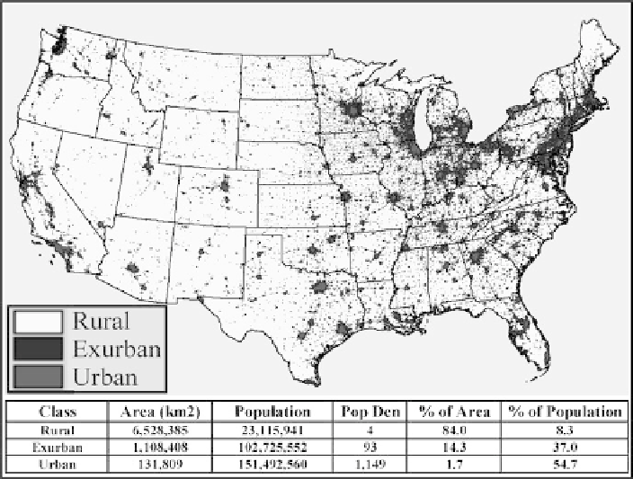
Fig. 17.6
Rural, exurban, and urban areas defined from DMSP OLS imagery
10. Perhaps the nighttime imagery may be used in the future as simple means of
delineating 'exurban' areas.
17.4.2
Case Study #2 (Developing Country): Exploring
the Use of Nighttime Imagery in Guatemala
Guatemala is one of the least developed countries in the western hemisphere. It is
a nation slightly smaller in area than the state of Tennessee with a population of
over 13 million people. The capital, Guatemala City has a population of over 3 mil-
lion. Over 40% of the population is under 15 years old and approximately 60% of
the population lives in poverty. Approximately 50% of the population works in the
agricultural sector; however this only accounts for about 23% of GDP. The GDP
per capita in terms of purchasing power parity is about $3,700 per year (CIA World
Fact Book http://www.cia.gov/cia/publications/factbook/). These low levels of eco-
nomic development have been exacerbated by a long running civil war that ended
in 1996. Since then there have been many attempts at rural development including
rural electrification programs. Using nighttime imagery for mapping population or
economic activity is more problematic in less developed countries like Guatemala.