Image Processing Reference
In-Depth Information
In the second example, a clearer picture of the above-mentioned analysis was cre-
ated by (a) generating a more specified density map of only burglaries in another
district in Dubai, and by (b) following up changes for 6 months. The mapping pro-
cedures and hot spot analysis once again allowed the Dubai Police to decrease the
rate of burglaries (Fig.
16.8
).
16.4.3
Automated Vehicle Location (AVL)
Because the Dubai Police is a community and problem solving-oriented agency,
and starting with Intelligence Transportation System (McCormack and Legg
2000
),
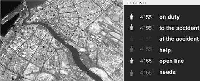
it has recently developed another in-house GIS application called Automated Vehicle
Location or AVL (Fig.
16.9
). The AVL application is based on four databases: data
server (network), map center, message center, and report generator (assessment). In
this application, the city of Dubai is classified into different districts. Each has a
special patrol code number, which is color-coded according to its function (on duty,
in-service, at the scene, rescue, needs, etc., see Fig.
16.9
).
The AVL system assisted in many aspects, especially in optimal vehicle dispatching,
patrol administration, and traffic control (Fig.
16.10
). In addition to traffic crimes
and accidents, the AVL system is used in community outreach activities and the
delivery of community-oriented services by improving the response time (Fig.
16.11
).
Although response time is a traditionally troublesome benchmark, it has been consid-
ered a relatively important measure of police efficiency and effectiveness since the
1930s. The relatively low-cost AVL system addresses the link between the GIS and
safety in the urban environment, and can also benefit the Emergency Management
System (EMS).
Fig. 16.9
(
a
) A snapshot for downtown Dubai showing the application of the Automated Vehicle
Location system (AVL) and (
b
) Legend describing the patrol code numbers