Image Processing Reference
In-Depth Information
16.4.2
Crime Hotspot Analysis
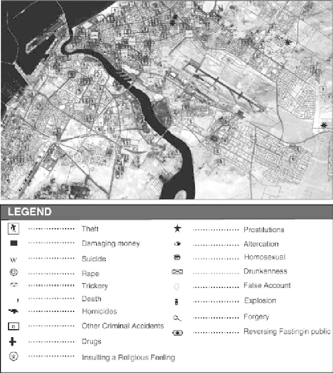
This and the following sections discuss some examples for analyzing crime sce-
narios in Dubai using GIS technology. The hotspot clustering application was used
to identify and mark the hotspots and displacement of different types of crime in
Dubai City and ultimately allowed for the recognition of relationships between
mapped crime patterns and socio-economic characteristics of the city's districts
(Fig.
16.6
).
Figures
16.7
and
16.8
show two examples of these applications. In the first
example, a density map of different types of crimes in Dubai City was created, which
showed clustering in certain districts of the city (Fig.
16.7
). In these clusters, crime
Fig. 16.6
Different types of crime at Dubai