Image Processing Reference
In-Depth Information
special awards. One of these applications is the Crime Analysis Extension
Application. This extension covers three broad categories of activities that constitute
community-oriented policing (crime analysis, patrol and administration). Accordingly
it provides tools regarding crime data and thorough geographical analysis. Another
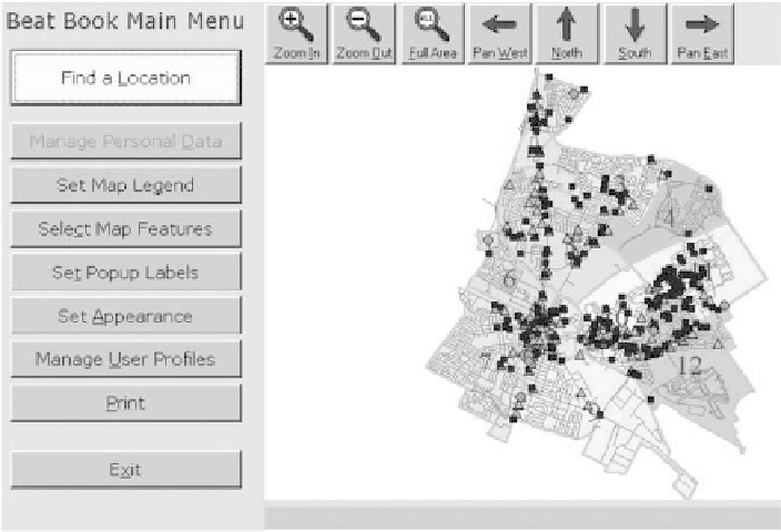
application which the NIJ has supported is the development of Community Policing
Beat Book Application, which serves community policing and has a variety of
features that provide information about the community and its management to make
fast and informed decisions regarding the crime field (Fig.
16.1
). Another applica-
tion is the SARA 4 Step Mapping Process for police problem solving as indicated
by Read and Tilly (
2000
) and Goldstein (
1977
). In this application, GIS mapping
is broken down into four stages for watching the problematic situations through
scanning, analysis, response, and assessment (Fig.
16.2
).
One of the most recent examples of GIS creativity in crime analysis is its utilization
in triangulating gunfire or what is generally called Shot Spotter (Fig.
16.3
). Shot
Spotter is a product that was specifically developed for law enforcement as an
“early warning system” for detecting gunfire locations across large urban areas
using a small number of inexpensive and easy use sensors. In the U.S., California
was the first state using this technology as in the Police Department of Redwood
City, California (Fields
2000
).
The potential uses of spatial data in crime analysis have been significantly developed
in recent years. These uses can be extended to monitoring parolees and people who
Fig. 16.1
Community policing beat book application (ESRI.com. Reproduced by permission)