Image Processing Reference
In-Depth Information
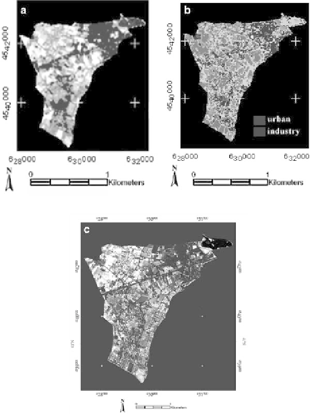
The IKONOS data analysis focused on the evaluation of urban changes in
Mimarsinan (834.9 ha), one of the sub-districts with main land use changes,
between 1998 and 2002 using NDVI. In the analysis, the NDVI was computed
for the LANDSAT TM (1998) and IKONOS XS (2002) scenes of Mimarsinan
using red and near-infrared band. A threshold was then applied to both NDVI
images to indicate areas lacking vegetation. A region of interest (RO) containing
all pixels with values that meet the NDVI threshold was established and con-
verted to vector format (DXF) for comparison (Fig.
15.7a, b
). The areal extent of
Fig. 15.7
Urban structures extracted from NDVI images of (
a
) LANDSAT TM (1998), (
b
)
IKONOS XS (2002), and (
c
) Maximum likelihood classification result of LANDSAT TM (1998)