Image Processing Reference
In-Depth Information
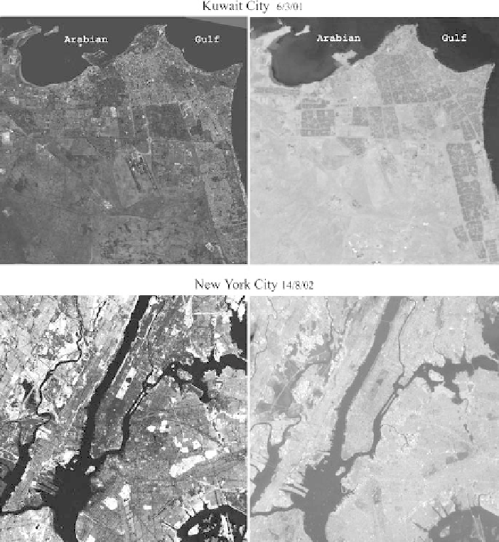
Fig. 14.1
Vegetation fraction and surface temperature images derived from Landsat 7 images for
Kuwait City and New York City recorded on March 6, 2001 and August 14, 2002, respectively.
Each scene is 30 × 30 km. Grayscale ranges from 0% to 100% for vegetation fractions (
left
) and
from 285 to 315 K (12-42°C) for surface temperature (
right
). Water bodies in the two images,
namely the Arabian Gulf and the Upper New York Harbor, the Hudson River and its tributaries
have zero vegetation fractions and the minimum temperatures and appear in dark tones in the
images. The brightness to contrast ratio in the Kuwait City vegetation image has been increased
by 30% so that features are visible
residential areas can be detected in the images. Even though New York City has abun-
dant vegetation, the surface temperatures are higher than Kuwait City, primarily due
to the different seasons. Notwithstanding the lower vegetation fractions, the cooling
effect is apparent in the clearly defined residential areas in the Kuwait City image.
Each of the scatterplots of surface temperature and vegetation fractions for
New York City and Kuwait City show a cloud of a triangular distribution of pixels