Image Processing Reference
In-Depth Information
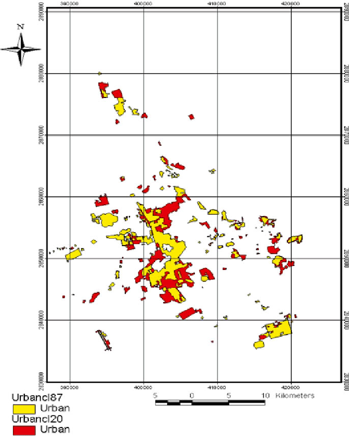
Fig. 13.5
Evolution map of urban areas in Al-Ahsa oasis during 1987 and 2001. © EOSAT
(1987-2001) - KACST/processed at AGU
facing many problems related to urbanization extension, deterioration of agricultural
lands, formation of new sabkha and new sand dunes. These findings confirm the
original hypothesis of the study.
Overlay of the evolution map and the road network map to localize the urban changes
and directions of such change was also performed. The cost of the study was estimated
at about US$9/km
2
and the delivery time of the analysis took about 4 months.