Image Processing Reference
In-Depth Information
the highest spatial accuracy. This will also be true if the imagette exhibits higher
level of “radiometric” accuracy than the image. For the purpose of the following
discussion, spatial resolution refers to the smallest area on the ground that an
imaging system, such as a satellite sensor, can distinguish.
Firstly, we illustrate the benefit of the encrustation of higher resolution data into
lower resolution image. Then, we propose a method for the attenuation of the edges,
which can help identify the limits between both resolutions and better simulate the
actual data at the highest resolution. A Quickbird image is utilized to provide a didactic
example of the problems and solutions associated with the encrustation process,
as well as a test case to assess quantitatively the qualities of the image resulting from
the merging. Other case studies and examples can be found in Ranchin (
1997
).
11.3.1
Benefits of Encrustation
The benefit of encrustation is illustrated by an examination of the loss (respectively
gain) of information when degrading (respectively upgrading) the resolution of an
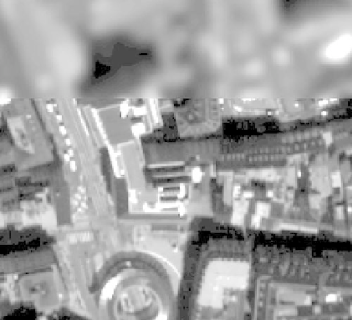
image. A Quickbird image of the city of Strasbourg, located in the Northeast of
France, is used in this example. Its spatial resolution is 0.7 m. It is called the original
or reference image.
The smoothing of this image provides an imagette whose pixel size is still 0.7 m,
but its effective resolution is 5.6 m, hereafter referred to as a “5.6 m smoothed
image”. Figure
11.2
displays an encrusted image resulting from the encrustation of
Fig. 11.2
A lower resolution image with a higher-resolution encrusted imagette