Information Technology Reference
In-Depth Information
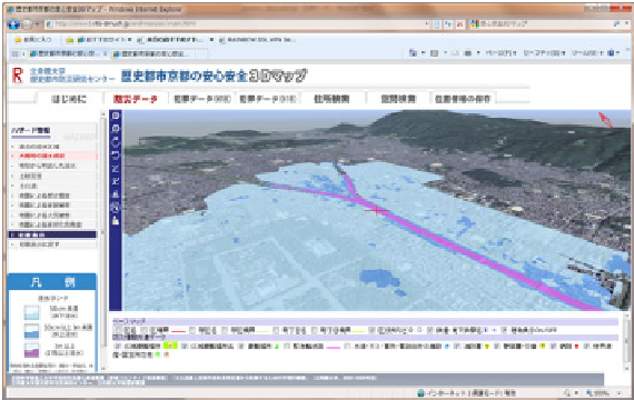
A bird's eye view on flooding risk along Kamo river
View of building collapse risks caused by a possible earthquake
(Hanaore fault) around Higashi-Honganji temple
Fig. 8.
3D hazard map generated using Virtual Kyoto
information is maintained by ArcGIS and PhotoField [19], a photo-album application
with geographic information (Fig. 9). The machiya survey entries include: its type, its
condition, design elements of the façade, and whether or not it is vacant. Such
information of overall machiya condition with accurate geographical coordinates may
be useful for assessing hazard risks of neighbourhoods filled with machiya (e.g. for
fire propagation or road blocking) as well as for realising fragmented historical
cityscapes at a risk of being lost by a possible disaster.
Combining such field survey results of historical buildings with the 3D hazard map
using Virtual Kyoto would efficiently empower policy makers as well as local
residents to consider the necessity of formal and informal rescue organizations to
protect or prepare endangered cultural landscapes for future disasters.