Geology Reference
In-Depth Information
82
o
Atlantic
Ocean
Gulf of
Mexico
26
o
26
o
N
10,000
Islands
Northwest
cape
Cape
Sable
82
o
W
Collapsed marsh
Middle
Cape
Canal
A
Homestead Canal
B
Middle
cape
West
South
Southern Lakes
East
Side
Creek
East
Cape
Canal
East
cape
Hidden
Creek
012
kilometres
345
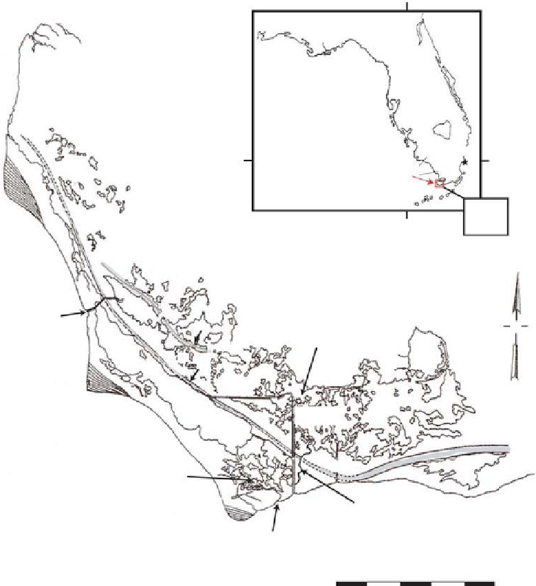
Fig. 1.
Location map of the Cape Sable study area along the southwest coast of the Florida Peninsula, showing
(1) prominent geomorphical features, (2) relict coastal levees in grey tints (A and B refer to dates in text), (3) Homestead
Canal (HSC) West and South and East Cape Canal (ECC) respectively accentuated in solid black and red. Modifi ed from
Roberts
et al
. (1977).
subenvironments of the study area: Homestead
Canal (HSC) connects Lake Ingraham to the inland
marshes as it cuts through the slightly higher
(<0.5 m above mean sea-level) marl ridge; Middle
Cape Canal (MCC) provides tidal exchange
between the Gulf of Mexico and the northern por-
tion of the coastal lagoon; East Cape Canal (ECC)
joins Lake Ingraham to Florida Bay as well as to
HSC (Fig. 1). One natural creek, East Side Creek
(ESC) (Fig. 1), cuts through the marl ridge, con-
necting the inland marsh with ECC. A natural
creek, Hidden Creek (HC), connects Florida Bay
with the Southern Lakes (Fig. 1). These canals
have all played an important role in the initial and
ongoing saline intrusion into the southern interior
of Cape Sable.
CLIMATE, WIND AND TIDES
South Florida's climate is subtropical and the
seasons are defi ned by rainfall amounts.
Precipitation averages 120-160 cm annually, of
which 60% falls in the summer months June to
September (Duevier
et al
., 1994). Cape Sable is
affected only minimally by freshwater discharge