Environmental Engineering Reference
In-Depth Information
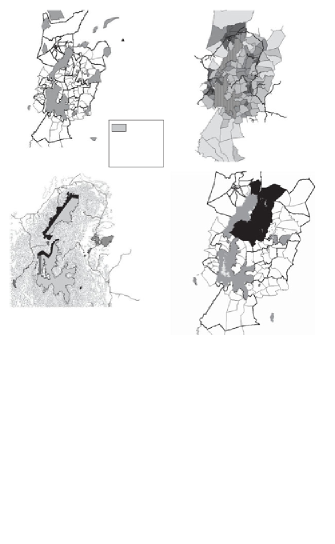
Morogoro town
Uluguru North
Forest Reserve
North
20 km
North
Forest
reserves
Village
boundaries
Uluguru South
Forest Reserve
Boundaries between
villages
Roads and tracks
Ward
boundaries
a)
b)
Forest outside the
reserves in this area
has been extensively
converted to banana
plantation
Pitsawing
Fire wood
collection
Commercial
agriculture
Mining for
rubies
Roads
c)
d)
Note:
a) location of government-owned Forest Reserves, b) human population density in
the wards around the Ulugurus in 1988, c) main threats facing the forests of the area, and d)
main area of project intervention during Phase II DANIDA support.
Source:
WCST Uluguru Mountains Biodiversity Project.
Figure 3.2
The Uluguru Mountains landscape, showing geographical
features of importance when designing an ICDP
potential is better (Figure 3.2c). Most people living on the mountains are
poor (Hartley and Kaare, 2001). For an outsider it is quite a daunting
region and a car can only reach a few higher regions of the mountain.
However, for the people of the Ulugurus, paths link nearby villages and
there are paths crossing the mountains to facilitate longer-distance travel-
ling. It is often quicker to walk (or run) over the mountain than it is to
drive around it. Distances are measured in hours of walking.