Geoscience Reference
In-Depth Information
sensitivity of landscape response to climate change and involve numerous complex
interactions among climatic, geological, and geomorphological processes. Our
understanding of the dynamics of landscape evolution and the linkages between
climate, Earth surface processes, and tectonics across a wide range of spatial and
temporal scales is ripe for substantial advances now that the advent of
thermochronometric methods provides data on erosion rates over geological
timescales, cosmogenic methods for dating geomorphological surfaces have matured
to the point of being readily accessible to researchers across the field, and high-
quality digital topography (such as LiDAR) is increasingly available for regions
around the world (see Figure 2.14).
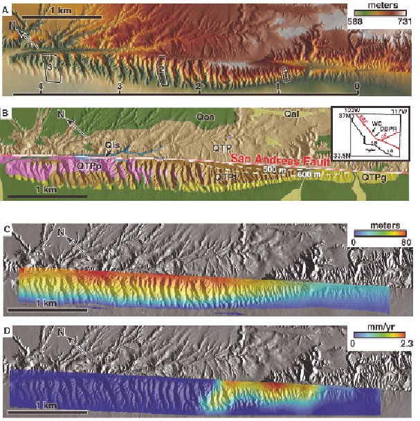
Figure 2.14
Combing LiDAR data with geological observations allows the response
of erosional processes in small drainage basins to rock uplift to be determined for the
first time in the field at a Dragon's Back pressure ridge along the San Andreas Fault.
These types of detailed measurements were not possible prior to the advent of
LiDAR mapping. (A) Airborne Laser Swath Mapping (ALSM) topography (1-m
digital elevation model); (B) geology; (C) total rock uplift (~140 k.y.) inferred from
distribution of geological contacts; and (D) instantaneous rock uplift rate. SOURCE:
Reprinted from Hilley and Arrowsmith (2008) with permission of Geological Society
of America. See original text for further explanation.
Search WWH ::

Custom Search