Geography Reference
In-Depth Information
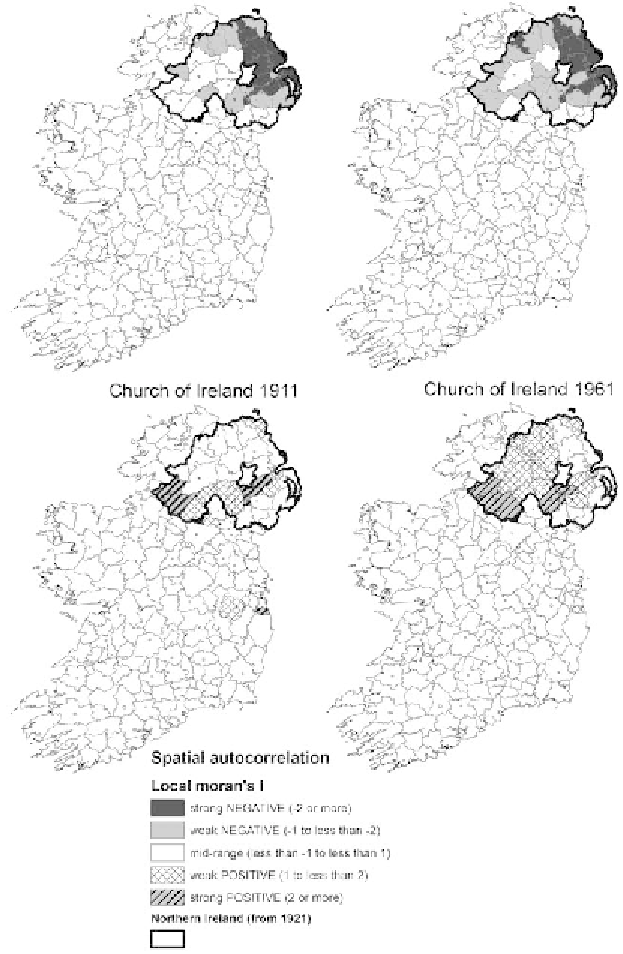
3.3.
District-level maps from the local Moran's
I
autocorrelation analysis, identifying
particular clusters of districts in 1911 and again in 1961. The maps are based on their
percentage Catholic (
top
) and percentage Church of Ireland (
botom
) populations.