Geography Reference
In-Depth Information
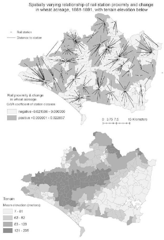
1.5.
Spatially varying relationship between railway station proximity and change
in wheat acreage, 1881-91, with terrain elevation (
below
). U.S. Geological Survey
(USGS) Earth Resources Observation & Science (EROS) Center, Shutle Radar
Topography Mission (2000), version 4 (2008) produced by the CGIAR
Consortium for Spatial Information, htp://srtm.csi.cgiar.org/.