Geography Reference
In-Depth Information
6.1.
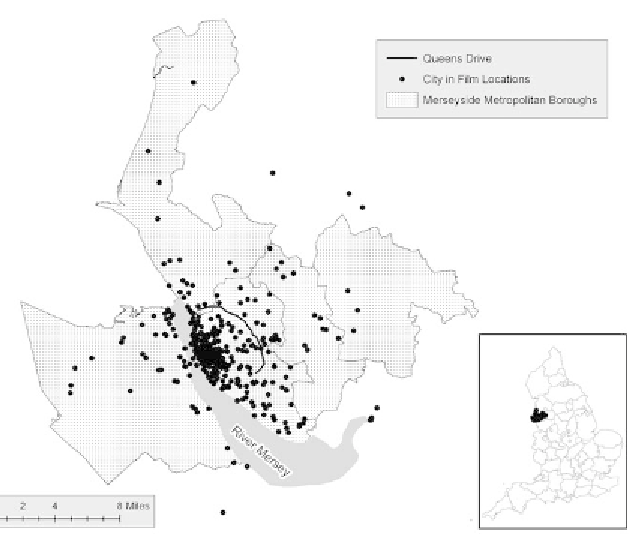
Map of Merseyside film locations showing the Queens Drive boundary.
regionally defined object of enquiry. As might be expected, the densest
cluster of locations is found in and adjacent to the central areas around
the Pier Head, William Brown Street, and Hope Street (Vauxhall, Ever-
ton, Dingle, and Abercromby Wards), the areas that form the central
axis of the city and house its principal civic, commercial, and religious
buildings and arts, education, entertainment, and leisure venues, but
there are numerous locations in outlying districts beyond the Queens
Drive boundary clustered around the airport at Speke, the racecourse at
Aintree, and the wealthier suburban areas (figure 6.1).
Since the earliest of moving image representations of Liverpool was
filmed from a carriage on the Overhead Railway in 1897 (the Lumière
Brothers'
Panorama pris du chemin de fer électrique
), transport has con-
tinued to be an important feature of films made in and around the city,
a factor that has demanded close analysis of the role of transport infra-