Environmental Engineering Reference
In-Depth Information
scheduling, efficient application, efficient transport
systems, utilization and reuse of tailwater and runoff,
and management of drainage water. IWM is particularly
effective in reducing nitrogen and pesticide loadings to
groundwater and salt loading to surface waters. Tailwa-
ter pits (which are pits to catch water that runs out of
the furrows at the end of a field) are about 50% effec-
tive in sediment removal and can be highly effective in
nutrient and pesticide pollution control as long as the
water collected is reused and not discharged.
6.3.3.13 Stream Bank Stabilization.
Stream bank
stabilization consists of structural or vegetative methods
to protect the stream bank from erosion. Riprap, con-
crete, wood, or rock gabions can be used, but vegetative
stabilization is the most effective for pollution control.
Effective stabilization can reduce the sediment loading
by 90%, but is highly dependent on the type of vegeta-
tion used and the stability of the reclaimed area.
6.3.3.14 Range and Pasture Management.
Range
and pasture management consists of systems of prac-
tices to protect the vegetative cover on pastureland and
rangeland. It includes such practices as seeding and
reseeding, brush management, proper stocking rates,
proper grazing use, and deferred rotation systems.
Rangeland is generally in native grass and managed as
a range, whereas pastures are normally seeded to an
improved grass variety and managed with agronomic
practices. Keeping land permanently covered in high-
quality closely spaced vegetation decreases soil loss to
negligible amounts, and sediment and adsorbed pollut-
ants are not lost from the land surface. Since rangeland
is not fertilized, it can represent a low-input system if
managed properly. Typical rangeland is illustrated in
Figure 6.29a, and a grass drill being used to interseed
native grasses into a pasture is illustrated in Figure
6.29b.
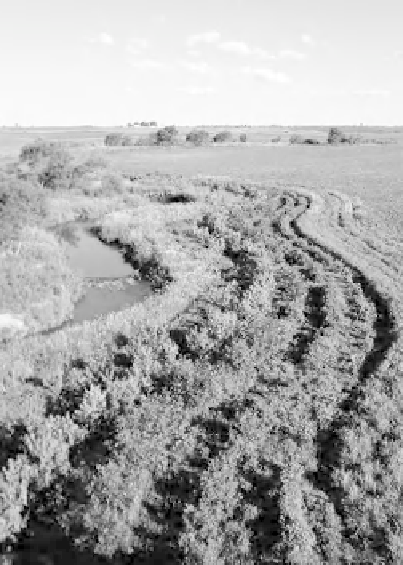
Figure 6.28.
Filter strip adjacent to Bear Creek.
Source
:
Natural Resources Conservation Service (2005b).
TABLE 6.15. Guidelines for Effective Buffer Widths
Width
Objective
(m)
(ft)
Stream bank stabilization
3-10
10-30
Water temperature moderation
3-20
10-70
Water quality
15-30
50-100
Nitrogen removal
8-40
25-130
Sediment removal
10-50
30-160
Wildlife habitat
10-90
30-300
6.3.3.11 Riparian Buffer Zones.
A riparian buffer
zone is a vegetated area along the perimeter of a water
body. The grasses and low vegetation in the buffer zone
filter both surface and subsurface flow, while roots of
taller vegetation take up and transform pollutants and
nutrients from shallow groundwater. A riparian buffer
is shown in Figure 6.28. The wider the buffer, the greater
the opportunity for the buffer to perform its functions.
The desirable width of the buffer can be related to its
function, as shown in Table 6.15.
6.4 AIRSHEDS
An airshed is commonly defined as the geographic area
responsible for emitting 75% of the air pollution reach-
ing a body of water. Since different pollutants behave
differently in the atmosphere, the airshed of a given
body of water may vary depending on the pollutant of
interest. Whereas watersheds are actual physical fea-
tures of the landscape, airsheds are determined using
mathematical models of atmospheric deposition. Air-
sheds are very useful in explaining the transportation of
pollutants and can help manage a body of water much
more effectively. Airborne pollution can fall to the
ground in raindrops, in dust, or simply due to gravity. As
6.3.3.12 Irrigation Water Management.
Irrigation
water management (IWM) consists of a combination of
practices that control irrigation water to prevent
pollution and reduce water loss. IWM includes proper


Search WWH ::

Custom Search