Environmental Engineering Reference
In-Depth Information
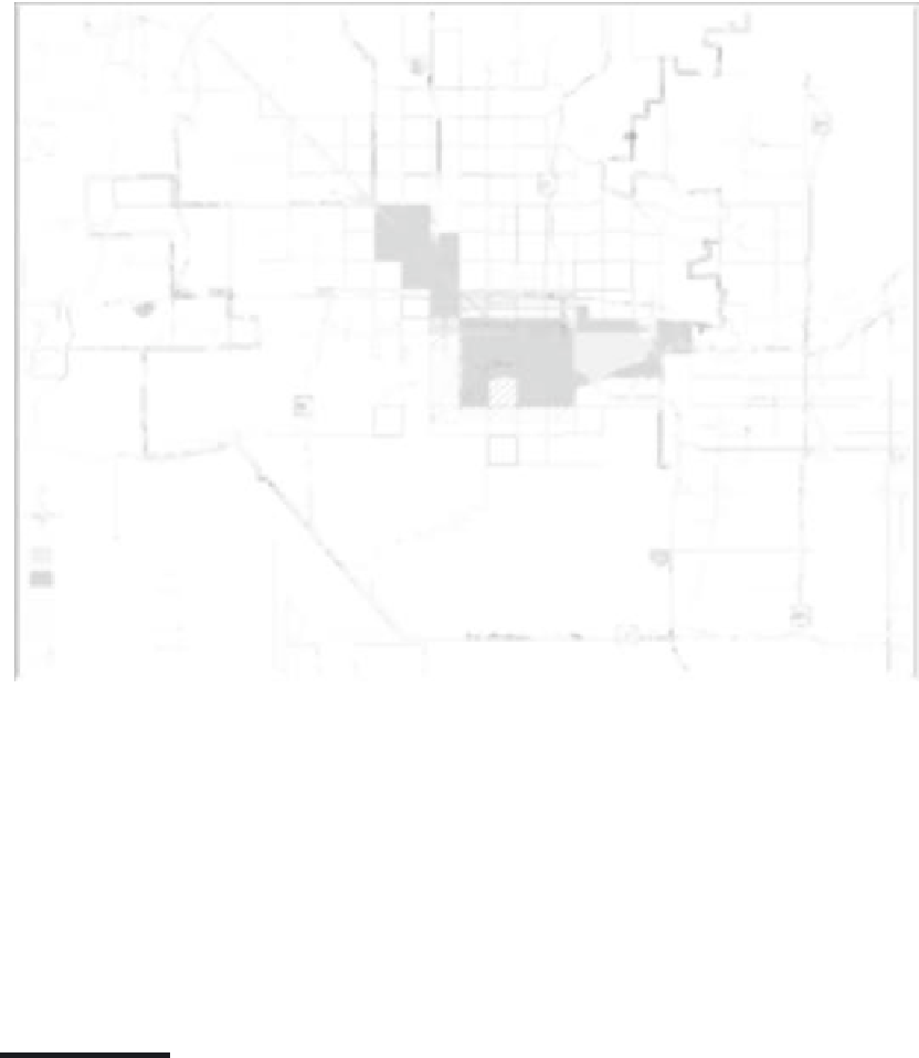
Sky Harbor airport
Railways
U.S. hwys
State hwys
Proposed hwys
SaltRiver
Freeways
Study area
South Phoenix
Phoenix boundary
CBD
FIGURE 17.1
High hazard census tracts in the Phoenix metropolitan area.
although the population in these tracts has remained relatively steady, currently with a
population of 64,590. The study area has become increasingly Latino, more than doubling
to 67% in 30 years, and has growing rates of poverty—in some tracts more than five times
the city-wide rate of 12%. The “Latinization” of the high hazard area is most pronounced
in the western portion of the study area where some tracts have gone from less than 3%
Latino to more than 60% over the last 30 years.
17.5 Toxic Tracts: Production of Environmental Inequality
The history of this area offers important insights into the sociospatial practices that have pro-
duced environmental inequities in Phoenix. This 20-tract “toxic archipelago” has been pro-
duced over a period of decades by race-based housing segregation and public disinvestment
in conjunction with a variety of zoning, siting, planning, and investment decisions across
the metro area. Phoenix's first industrial district, in what is now known as South Phoenix,
began developing along the east-west rail corridor south of the CBD in the early twentieth
century (see Figure 17.1). The rail corridor functioned both as an anchor to industrial activity
and as the physical dividing line between white north Phoenix and Black and Latino South
Phoenix.
26
Initial South Phoenix industrial development along the rail corridor included

Search WWH ::

Custom Search