Environmental Engineering Reference
In-Depth Information
velocities nearest and parallel to the fault.* Variability in soils and bedrock again causes com-
plexities but the overall pattern of horizontal velocity normally is simpler than peak accelera-
tions. Severe damage and damage to flexible structures are best related to ground velocity.
Following large earthquakes, spectral response maps are used to portray the response of
a damped, single degree-of-freedom oscillator to the recorded ground motions. This data is
useful for engineers to determine how structures respond to a range ground motions caused
by periodic motion; specific reference periods are defined within the Uniform Building Code
(UBC) to define the design spectra for infrastructure. ShakeMap spectral response maps
†
are
made for the response at the three UBC reference periods of 0.3, 1.0, and 3.0 s.
Numerous tools are available to assess earthquake hazards, and almost all of these are
internet-based with frequent updates. For most states, the state geologic surveys have
prepared fault maps,
‡
amplified ground shaking maps, and liquefaction potential maps,
§
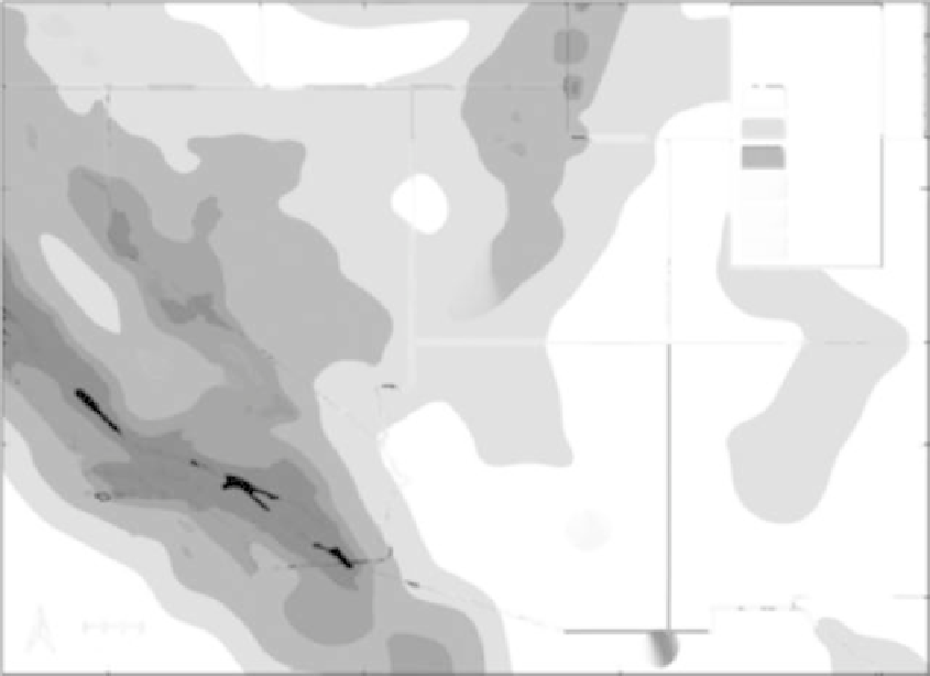
as well as earthquake-induced inundation, or tsunami, maps. Maps of peak horizontal
acceleration (Figure 5.8) are the most common means for describing regional seismic
120°W
110°W
Horizontal
acceleration
(% gravity)
1-5
6-10
11-20
21-30
40°N
31-50
51->100
35°N
N
100 miles
FIGURE 5.8
Seismic hazard map for the southwestern United States. (From http://gldims.cr.usgs.gov/nshmp2008/viewer.
htm, accessed June 29, 2009.) The units are peak horizontal acceleration, as a percentage of gravity, presented as
a 10% probability of occurrence in the next 50 years. Seismic hazard, therefore, increases with increasing shades
of gray.
*
http://earthquake.usgs.gov/earthquakes/shakemap/background.php#velmaps (accessed June 23, 2010).
†
http://earthquake.usgs.gov/eqcenter/shakemap/background.php#velmaps (accessed June 27, 2009).
‡
http://www.data.scec.org/faults/faultmap.html (accessed June 23, 2010).
§
http://geology.utah.gov/utahgeo/hazards/liquefy.htm (accessed June 23, 2010).

Search WWH ::

Custom Search