Database Reference
In-Depth Information
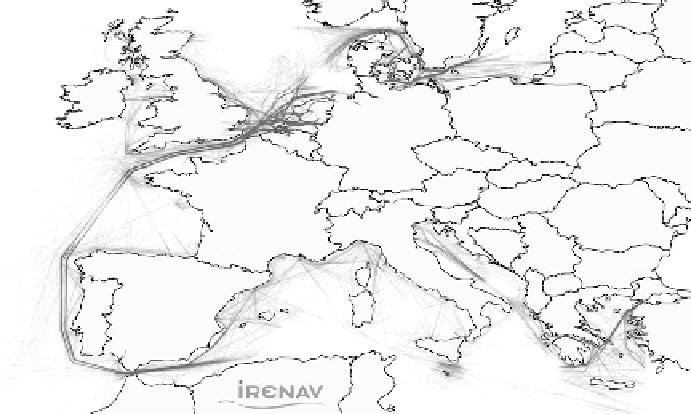
Figure 11.1 Ships' trajectories, density map in Europe during one month (AIS positions,
December 2010).
Such disasters and damages often lead to highly negative effects on maritime
ecosystems and are threats not only for the important populations of marine
protected and endangered species, but also for economic, scientific, and cultural
sectors. Safety and security have therefore become a major concern, especially
in Europe.
Consideration of this security issue by the International Maritime Organiza-
tion (IMO) has partly evolved in the last decade from ship design, education, and
navigational rules (e.g., International Regulations for Preventing Collisions at
Sea: COLREGS), to technical answers for traffic monitoring. Nowadays, ships
are fitted out with almost real-time position report systems whose objective is
to identify and locate vessels at distance. Figure
11.1
shows, for instance, ships'
trajectories obtained through the AIS in Europe during one month.
The maritime environment, represented in Figure
11.1
, is diverse and open,
but partly ruled. Regulation is ensured by Traffic Separation Schemes (TSS) set
up in order to split and regulate the traffic in crowded spaces into traffic-lanes,
and by the definition of exclusion areas and Particularly Sensitive Sea Areas
(PSSA) the ships have to avoid (e.g., biodiversity areas). Trajectories in such an
open space are very typical; ships often behave similarly, traveling in straight
lines, leading to visually noticeable trends and patterns. This naturally favors the
analysis of aggregated behaviors in order to detect maritime routes, dense areas,
evolution of the traffic, and finally, at individual levels, abnormal trajectories
and locations.