Environmental Engineering Reference
In-Depth Information
Results and Discussion
The common premise governing environmental assessment and landscape planning
procedures should be “to devote the greatest possible effort to the most signifi-
cant problems”. Therefore,
[10]
recommends using evaluation criteria to identify
critical environmental areas in order to limit the area involved in the landscape
planning. We use the criteria of environmental quality to identify critical areas
in Spain.
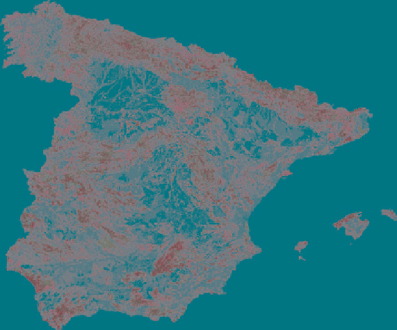
In our example, a total of 102,240 different vectors are obtained with 12 compo-
nents, assigned to each of the 50 million 1-ha grid squares for Spain. The classifica-
tion of the vectors (vector modulus) provides a raster map with 100 classes of
territorial environmental quality (Fig.
1
). The raster layers and the combining and
reclassifying operations are able to deal with enormous amounts of information
with no difficulty at all.
The distribution frequency for each of the quality classes is very suitable for
the development of landscape planning procedures (Table
1
). The model shows that the
planning of land-use activities would be acceptable in 48.28% of Spanish territory,
Fig. 1
Assessment model of territorial natural quality in Spain (LATINO model - 100 natural
quality classes). Metadata: European projection standard Lambert Equal Area and Datum
ETRS89. One hundred metres pixel-raster maps. Model scale: 1:500,000. Colour codes: low
natural quality classes 1 to 39 = light grey; natural quality classes 40 to 59 = grey; natural quality
classes 60 to 79 = dark grey; greatest natural quality classes 80 to 100 = black