Environmental Engineering Reference
In-Depth Information
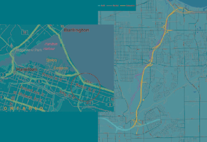
Fig. 2
Location map and route plan for the RHVP
section of the city's crucial transportation artery. The 7.5 km long RHVP is located
in an environmentally sensitive area in the City of Hamilton along the Red Hill
Creek
[4]
(Fig.
2
). The City of Hamilton decided that, given the projected traffic
volumes, the traditional pavement designed for a 20-year life might not be accept-
able and that a more radical and sustainable approach was needed. A feasibility
study was completed comparing both pavement design alternatives. The RHVP is
projected to sustain more than 30 million Equivalent Single Axle Loads (ESAL's)
over a 20-year period. The conventional pavement design, based on geotechnical
investigations completed between 1999 and 2004, was to support a 20-year traffic
loading.
Perpetual pavement designs were then completed for all sections to support the
traffic loading over a period of 50 years (90 million ESAL's). The selected pave-
ment designs for both alternatives are shown in Fig.
3
. The perpetual pavement
incorporates an 80 mm layer of an asphalt-rich mix, which will protect against the
initiation of load induced fatigue (bottom-up) cracking.
A life cycle cost analysis was undertaken to compare the perpetual pavement
design to the conventional asphalt pavement alternative. The Ministry of
Transportation approach was used
[6]
.
The results (just considering the main lane pavements) confirm that while the
initial construction costs for the perpetual pavement design is higher, the long term