Environmental Engineering Reference
In-Depth Information
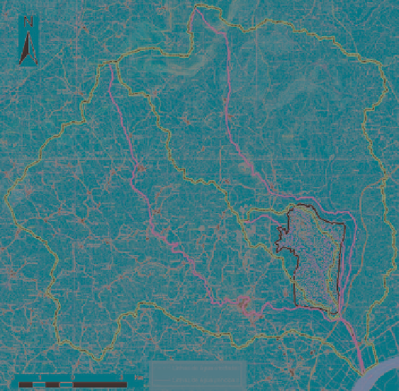
Fig. 2
Ota location
In the case of Ota, shown in Fig.
2
, the airport platform is placed almost at the
end of the Ota and Alenquer watersheds. It covers almost two third of the Alvarinho
watershed (65%), a sub-basin of the Ota River. This position leads to an increase of
the drainage area and to a large inundation area. Besides, the high slopes contribute
to a reduction of the time of concentration and to an increase of the flood dis-
charges. In addition, the proposed platform is located at the confluence of three
rivers and in a zone where the tide influence occurs. The combination of flood
events with high tide levels prevents the water flow and, consequently, extended
areas are flooded. This happens frequently, therefore, in the case of choice of this
location, the accessibility to the airport would have severe constraints. According
to this scenario, there is a demand for significant flood control constructions,
including dikes and regularization works on river Ota, and a dam and deviation
pipes for the Alvarinho River.
The CTA option is located at the headwaters of the Vale do Cobrão Watershed
(Fig.
3
) where the slopes are mild. For that reason the flood discharges are not as
important as at the Ota location. The construction works needed to ensure the flow
of the floods are not very complex, and can be implemented with relatively small
costs. Summing up, the ratio of the flood discharges at the two locations is about
one to three. In CTA the flood discharge for a return period of 100 years is approxi-
mately 70 m
3
/s, and for Ota about 226 m
3
/s. Moreover, the topography is much