Geology Reference
In-Depth Information
Similarly, the coastal features of the northeastern United States (such as Cape Cod, Mas-
sachusetts) are the result of glacial deposition during the Pleistocene ice age. (Check
out Chapter 21 for the scoop on recent ice ages.) The glacial features, including mo-
raines (see Chapter 13), are still the dominant feature shaping the coastline.
Another type of primary coast occurs when large rivers empty into the sea. The pro-
cesses of stream erosion and deposition associated with flowing water (I explain these
in Chapter 12) shape the coastline in these regions, such as the Mississippi River outlet
into the Gulf of Mexico in Louisiana.
Heading for higher ground: Tsunamis
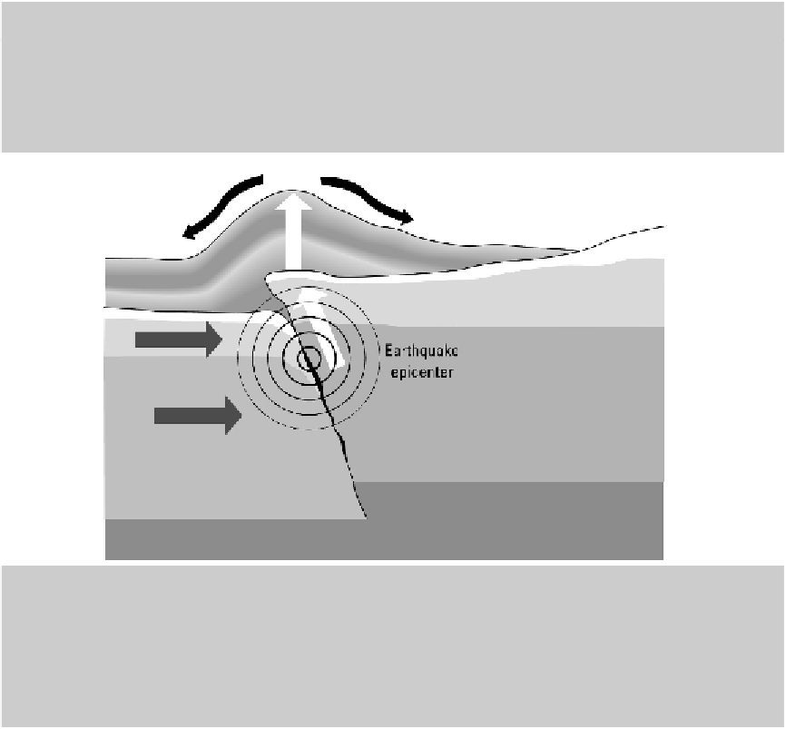
A
tsunami
is a series of very large waves that travel across the ocean following an undersea geologic
event such as an earthquake, volcanic eruption, or landslide. Most often tsunamis are the result of un-
dersea earthquakes. As illustrated in the first figure in this sidebar, the movement of the seafloor when
an earthquake occurs displaces a large amount of water. This water then moves across the sea as a
large wave.
The danger in tsunami waves is that they are not visible the way normal ocean waves are, and they
result in much more destruction when they reach the shore. In the deep ocean, a tsunami wavelength
can be hundreds of miles in length and only a few feet in height, which means a boat floating in the
ocean wouldn't even notice as the tsunami passed it. The wave can travel hundreds of miles an hour,
crossing the entire Pacific Ocean in a matter of hours. This is comparable to the speed of a commercial
airliner. In 1960, an earthquake on the coast of Chile in western South America generated a tsunami
that hit the east coast of Japan less than 24 hours later.