Environmental Engineering Reference
In-Depth Information
(LST). Each forecast is obtained by forcing the model with a different upper and
lower boundary condition defined from the local observations of five surface
weather stations and one upper air station.
At the lower boundary, a surface heating function defines the daily cycle of the
river-land temperature contrast which takes into account the geometry of the
coasts and confines the temperature gradient into a narrow band along the river
shores. The MBLM low-level wind field climatology of a 25-year period presents
a good agreement with the observed one. The averaged relative RMSE calculated
at five weather stations across the region is 35% for wind direction and 21% for
wind speed (Berri, 2007).
Figure 2
shows the averaged relative RMSE as a
function of local standard time. The errors in wind speed are almost constant while
the errors in wind direction show more dependence with time of the day and are
larger during the nighttime hours.
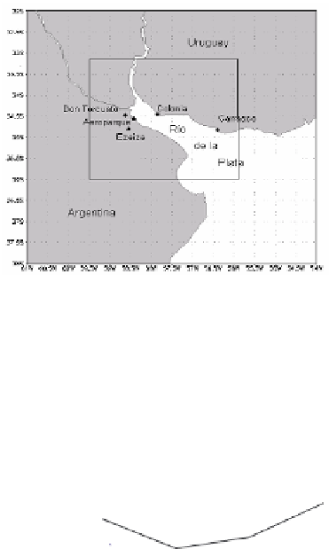
Fig. 1.
Location of La Plata River region in South
America. The inner rectangle is the model
domain
rms relative error
100
wind direction
wind speed
80
60
40
20
0
3
9
15
21
local standard time
Fig. 2.
Averaged relative RMSE as a function of local standard time