Agriculture Reference
In-Depth Information
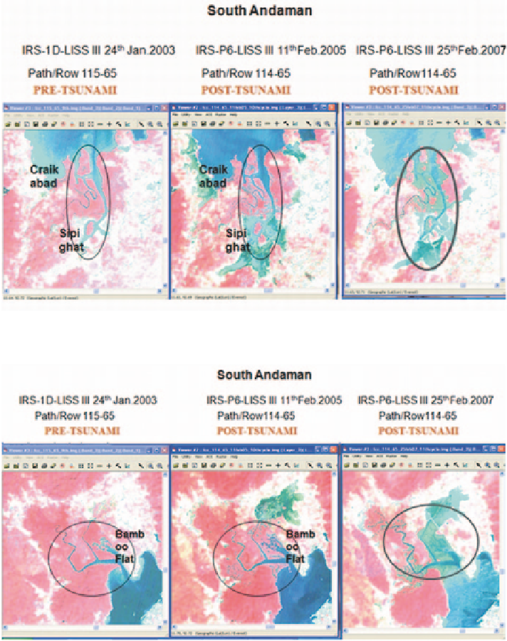
Fig. 2.9
Changes in mangrove cover of South Andaman from 2003 to 2007 (Sippighat area)
Fig. 2.10
Change in mangrove in part of South Andaman between 2003 and 2005 (Bambooflat
area)
The purpose of using satellite data in this study has been to substantiate the field
observations of researchers working in ANI and also of the forest staff managing
the mangrove areas that continuous degradation is going on in mangroves of North
Andaman, certain locations of South Andaman and in Nicobar Islands.
Figures
2.9
and
2.10
show changes in mangroves of two locations of South An-
daman Island. Figure
2.9
shows the gradual changes in mangrove area from the
year 2003 (pre-tsunami) to 2007 (post-tsunami) in Sippighat area. From the satellite