Environmental Engineering Reference
In-Depth Information
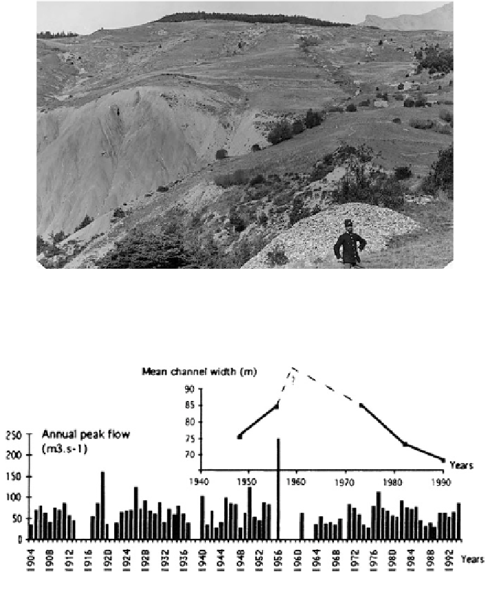
Fig. 2.10 An evolving land use: intense deforstation in the nineteenth century (agro-pastoral
communities); intense gullying (source RTM)
Fig. 2.11 Evaluation of active channel average width and annual peak flow from 1945 to 1990,
on the middle Ubaye (After Hydro bank data and aerial photographs) (source RTM)
Search WWH ::

Custom Search