Environmental Engineering Reference
In-Depth Information
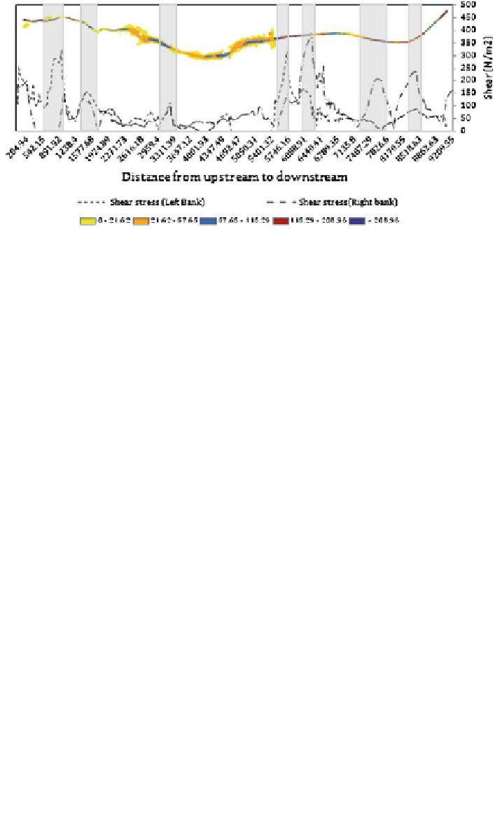
Fig. 6.61
Shear stress for scenario (4); gray color represents the critical locations to shear stress
6.10.4 Model Scenario
In the model scenario, the aim was to compare the different results in both HEC-RAS
and SOBEK to find the advantages and disadvantages of each model (Table
6.16
).
As explained in the last chapters, two different flood modeling packages were
used to simulate floods with different DEM resolutions in this study. Figures
6.62
and
6.63
show 1D and 1D-2D simulations in HEC-RAS and SOBEK. Both models
are sensitive to the DEM resolution. The main reasons herein are the basic dif-
ferential equations which deal with the pixel sizes. The models give us different
options in flood hazard assessment.
Based on the user's purpose, it has to be determined which model should be
applied. If engineers have to decide on dams or house enforcements against flash
flows, the SOBEK results are more suitable due to higher accuracy of flow velocity
results. However, if only the approximate extent of water is important (e.g., for
spatial planning procedures), the HEC-RAS model is sufficient.
The results of flood propagation in both models give better insight into flood
characteristics, e.g., where the water moves (inundation) and how fast the water
flows (water velocity). These results are very important as basic information for
Table 6.16
Model scenario comparison: HEC-RAS and SOBEK comparison
HEC-RAS (1D)
SOBEK (1D-2D)
Advantages
1. It simulates better results when
water stays within the channel
1. It has the capacity to model both in 1D
and 2D
2. GIS software necessary for data
creation, organization, and map
publishing
2. Strong to show inundation area
3. Some results as basis for policy making,
decision support and planning such as
duration, water level, warning time
3. Engineering to check and design
sediment, velocity, shear stress
Disadvantages
1. Depend on length of cross
section to show floodplain
interactions
1. Long time for simulation
2. No connection to GIS for data
preparation

Search WWH ::

Custom Search