Environmental Engineering Reference
In-Depth Information
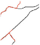
(a)
(c)
(b)
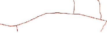
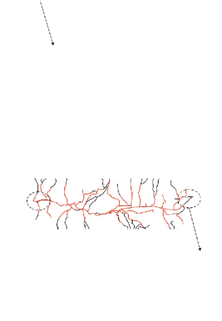
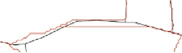
Fig. 6.21 a Generated river network from 5 m resolution DEM (red color) overlapped on actual
river network observed in the field (black color); b the agreement between observed and modeled
in upstream; c the agreement between observed and modeled in downstream
Figures
6.21
and
6.22
show the delineated river network from 5 and 10 m
resolutions which were compared with actual river networks observed in the field.
Visualization analysis shows that due to a low resolution of 10 m, compared to
5 m, the generated river network for 10 m deviates more and does not agree well
with the actual drainage paths. But with the increase of horizontal and vertical
(a)
(c)
(b)
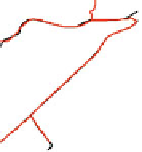
Fig. 6.22 a Generated river network from 10 m resolution DEM (red color) overlapped on
actual river network observed in the field (black color); b the agreement between observed and
modeled in upstream; c the agreement between observed and modeled in downstream


Search WWH ::

Custom Search