Environmental Engineering Reference
In-Depth Information
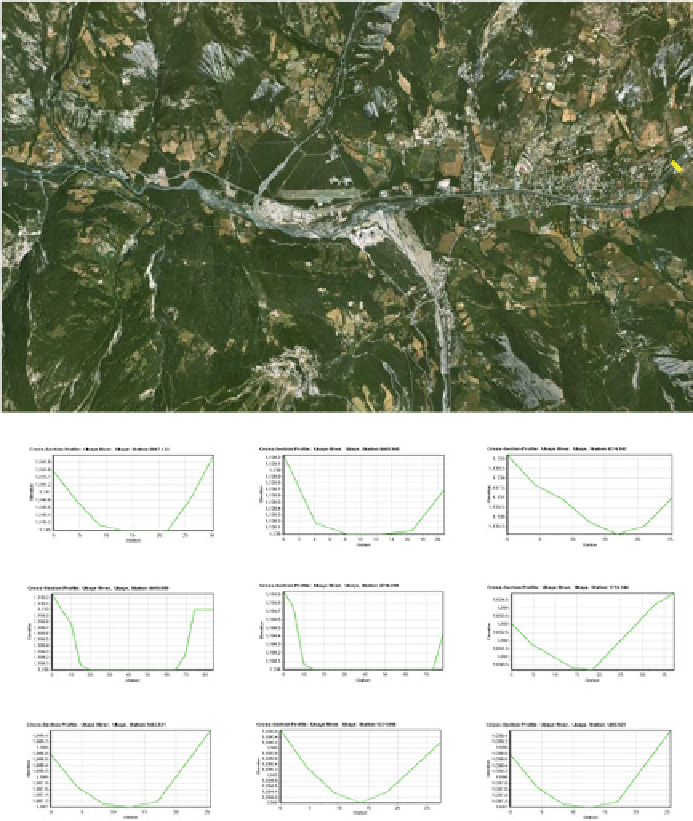
6.5 Creating Cross Section in the HEC-GeoRAS Model
The extent of cross section locations was represented by the cross sectional cut
lines layer based on a 5 m resolution DEM using the HEC-GeoRAS model
(Fig.
6.14
). As far as if any modeling represents prefect results, these cross sec-
tions also needed to be manually modified before being used in flood simulations
(SOBEK and HEC-RAS).
In SOBEK, the trapezium method was used to create a cross section and the
values of maximum flow width and bottom width and other information were
(c)
(a)
(b)
(e)
(f)
(d)
(h)
(g)
(i)
Fig. 6.14
Modeled cross sections at some sampled locations


Search WWH ::

Custom Search