Environmental Engineering Reference
In-Depth Information
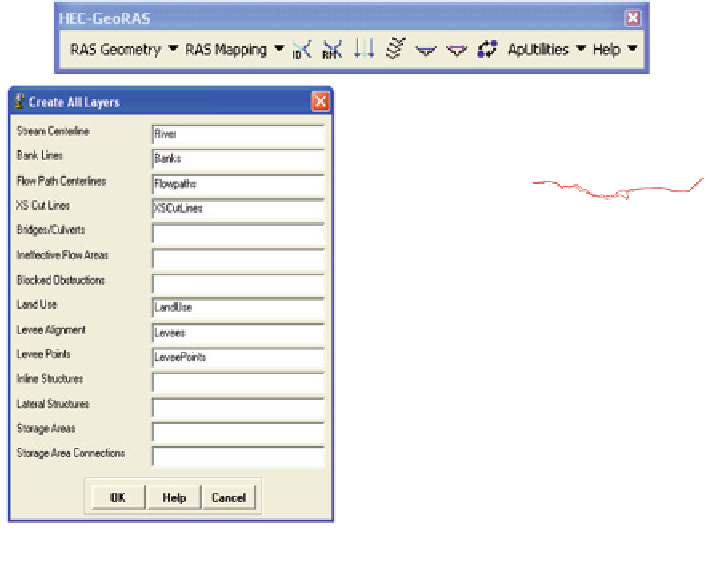
a.Rivercenter line
b.Left & right banks
c.Flow paths
d.XSCut Lines
e. Roughness
f.Levee points
Fig. 6.13
Typical RAS-Geometric data in HEC-GeoRAS applied in SOBEK and HEC-RAS
event when the government decided to increase the height of the dyke about 0.5 m.
Road generalization was made in the form of primary, secondary, service roads
and tracks, and heights of 0.5, 0.3, 0.2 and 1 m were assigned to different kinds of
roads, respectively, based on the literature review [
1
]. The building also added to
DEM as solid blocks hinder the flow water as it surpassed the building. Due to
limited data, heights of approximately 3 m were defined for all buildings.
6.4 RAS-Geometric Data
RAS Layers created and edited in HEC-GeoRAS model are necessary in both
SOBEK and HEC-RAS models for pre-processing geometric data development
and extraction. The layers are included center line, Flow paths, banks, polygon
layer of land use to estimate Manning's values, cross sections cut lines, and levees
(Fig.
6.13
).
After creating and editing each RAS layer, the RAS Geometry data were
imported directly into HEC-RAS model as SDF and XML format. These data also
imported to in SOBEK model as Ascii and Shp. files.


Search WWH ::

Custom Search