Environmental Engineering Reference
In-Depth Information
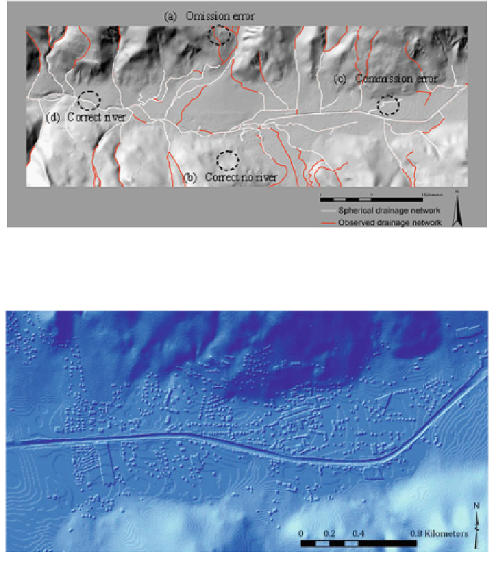
Fig. 6.11
The comparison between modeled and observed drainage networks, Spherical method
Fig. 6.12
Final DEM (City part) applied in modeling
6.3 Adding Feature Surface to DEM
For flood modeling, the DEM must contain all relevant surface features, such as
dykes, that affect the flow of water.
For this purpose, it was necessary to integrate the man-made terrain in
the DEM, including roads, dykes and buildings, and their respective values were
obtained from the fieldwork and previous databases and research in the area. The
final DEM was used in hydrodynamic modeling (Fig.
6.12
).
Two separate DEMs were produced: one for the 1957 flood event before
reconstruction and the height increase of the dykes, and one after the 1957 flood
Search WWH ::

Custom Search