Environmental Engineering Reference
In-Depth Information
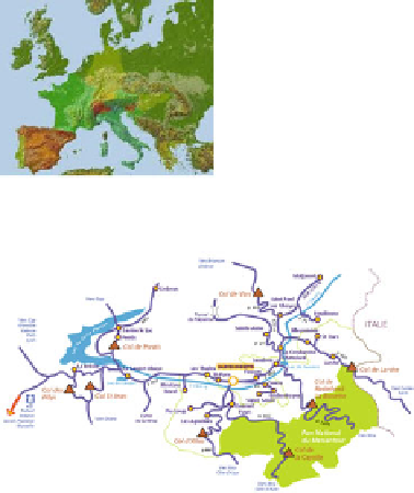
Fig. 4.1
Location of case study (Barcelonnette area) Alpes-de-Haute-Provence, France
The Ubaye Valley is representative of climatic, lithological, geomorphological,
and land use conditions observed in the South French Alps [
1
]. The study area is
located in the dry intra-Alpine zone, characterized by a mountainous Mediterra-
nean climate with a high interannual rainfall variability (400-735 mm over the
period of 1928-2005), a mean annual temperature of a ca. 7.5, and the presence of
a snow pack on the upper slopes for 4-6 months out of the year. Local summer
rainstorms can be intense, sometimes yielding more than 40 mm.h
-1
[
2
].
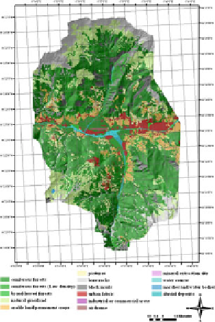
4.3 Geographical Characteristics of the Ubaye River
in the Whole Watershed
According to the data bank from 1903 to 1990, Parde [
3
] described the Ubaye
River as a fifth-order tributary of the middle Durance for the whole catchment. He
mentioned that it is a steep river (13 %) with a mean annual discharge of 10.1
(m
3
.s
-1
) (Table
4.1
).


Search WWH ::

Custom Search