Environmental Engineering Reference
In-Depth Information
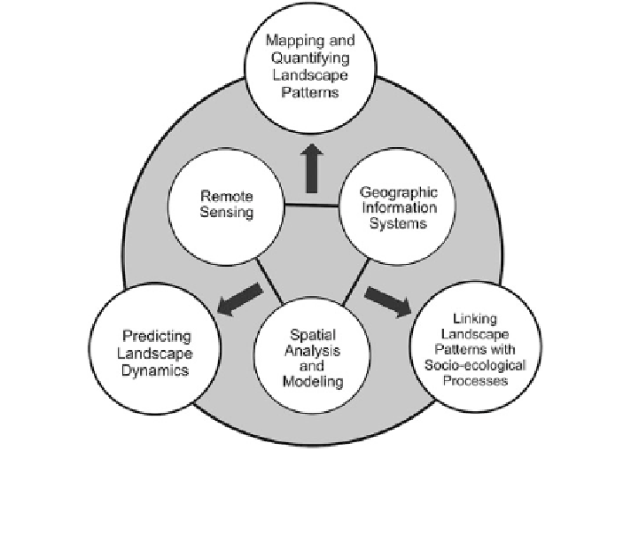
Fig. 11.1 A framework guiding the use of remote sensing and geospatial analysis for landscape
pattern characterization. While remote sensing provides an indispensable source of data for
landscape pattern mapping and quantification, GIS offers a platform for spatial data integration
and synthesis that can help link observed landscape patterns with socio-ecological processes and
for predicting landscape dynamics
direct observation of landscape pattern and process at various scales, GIS provides
a platform for integration and synthesis of theories and technologies in support of
landscape pattern analysis and modeling (Fig.
11.1
). The chapter is organized into
several major sections, beginning with a discussion of the research status identi-
fying some gaps in the use of remote sensing and GIS techniques in landscape
ecology.
Section 11.2
will examine remote sensing and landscape metrics for
landscape pattern mapping and quantification.
Section 11.3
will discuss some GIS-
based spatial statistical analysis and modeling techniques for examining patterns,
relationships, and emerging trends and for simulation and prediction. The last
section will summarize the major findings. While the topics covered in this chapter
span the entire spectrum in landscape analysis, our emphasis is not on a com-
prehensive review but on some methodological issues highlighting caveats and
cautions when using geospatial techniques in landscape ecology. We believe the
issues identified here can help landscape ecologists to better utilize remote sensing
and GIS techniques in their specific applications.
Search WWH ::

Custom Search