Geography Reference
In-Depth Information
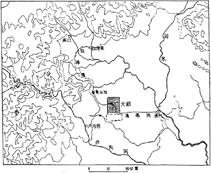
Fig. 1.4
Watercourses in the adjacent areas of Khanbaliq of Yuan Dynasty
བྷ䜭
Dadu City,
㾯ኡ
West Mountains,
▎≤
Lu River,
⋏⋣
Lugou River,
⋏ẕ
Lugou
Bridge,
䙊ᜐ⋣
Tonghui Canal,
䙊ᐎ
Tongzhou,
ইਓ
Nankou Pass (South Mouth Pass)
Now we can see that superfi cially, the summer palace of Jin Dynasty led to the
construction of the city of Dadu in this area. But in fact, the new source of water
from the Gaoliang River formed the decisive factor of the selection of city site in
this very place (Fig.
1.4
).
Here is a thing we must pay special attention to, that is, the determination of the
central axis of the city which was of the fi rst importance in the plane designing of
the city of Dadu. This central axis went along the east bank of the Water Storing
Pond. And the centre of the emperor's palace was fi xed on the central axis of the
whole city and it occupied the most important position. The apex of the central axis
was at the northeastern bank of the lake Water Storing Pond. This point was taken
as the geometric centre of the plane designing of the whole city. Here at this very
point was erected a designating building which was called “the Central Pavilion”.
On the right side of the pavilion was set up a stone tablet on which were inscribed
four Chinese characters, meaning “the Central Platform”. This shows that when the
planning and designing of the whole of the new city were made, a precise plane
survey was also made.