Geology Reference
In-Depth Information
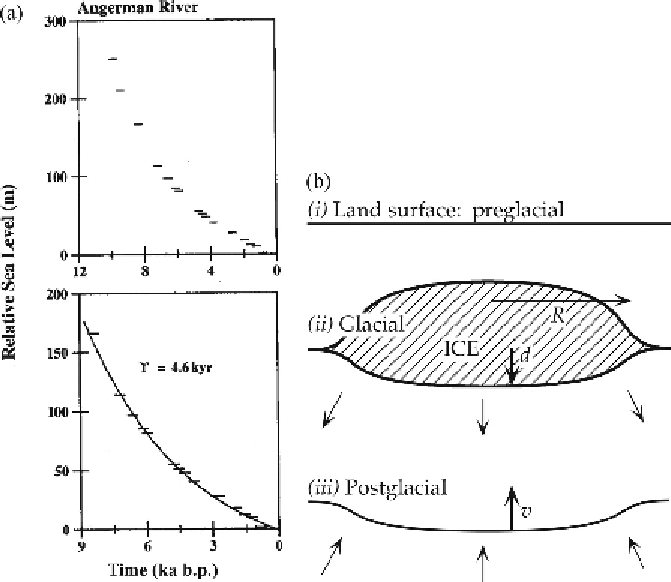
Figure 4.2. (a) Observations of the former height of sea level relative to the land
surface at the Angerman River, Sweden. From Mitrovica [37]. Copyright by the
American Geophysical Union. (b) Sketch of the sequence of deformations of the
land surface (i) before, (ii) during, and (iii) after glaciation.
The land surfaces of Canada and of Scandinavia and Finland (referred to as
Fennoscandia) have been inferred to be rising at rates of millimetres per year
relative to sea level. The main observation on which this inference is based is a
series of former wave-cut beach levels raised above present sea level. These have
been dated in a number of places to provide a record, which is usually presented
as relative sea level versus age. An example is shown in Figure 4.2(a).
The interpretation of these observations of recent and continuing uplift is that the
land in these areas is rising because the weight of thick ice sheets that were present
in the last Ice Age has been removed. The implication is that the ice depressed the
land surface as it accumulated, and that the land surface rises or 'rebounds' after
the ice has melted. The fact that the rebound is protracted rather than instantaneous
indicates that the mantle under these areas is behaving as a highly viscous fluid
rather than just as an elastic solid.
The ice sheets melted rather rapidly around 11 000 years ago. Since that time
there has been a clear slowing of the rate of uplift, as can be seen in Figure 4.2(a).