Geoscience Reference
In-Depth Information
3.6 Computer Printers
There is no space to give a comprehensive overview of computer printing in this
paper, so only the most relevant techniques will be discussed. The development of
computer technology before the release of personal computers was focused on the
calculation speed. This was also the time when the theory of the geographic infor-
mation systems was developed. In the 1960-1970 years there was not too much
focus on output devices in informatics. At that time matrix printers were nearly the
only opportunities to make output from digitally stored data. These devices were
produced to print text (characters) based on simulating the well-known “output
device”, the typewriter using a so called impact printing. However these devices
were driven by the computer at a much larger speed than any human could do. What
was much more important in the cartographic point of view is the print size. In the
industrial and scientific environment where financial resources were available such
kind of large format line matrix printers and (later) dot matrix printers were used.
This large output size (wider than the 80 columns of an A4 sheet) became available
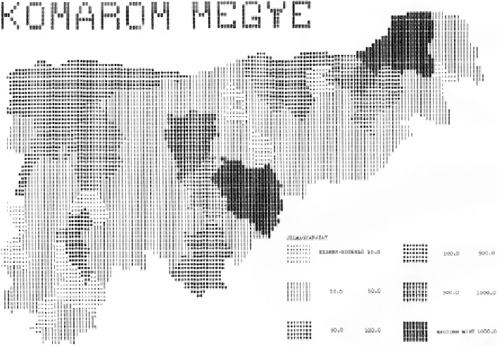
in the 1970s. The Harvard Laboratory for Computer Graphics (and Spatial Analy-
sis) developed an automated mapping application called SYMAP, to produce
isoline, choropleth and proximal maps on a line printer around 1960. This technol-
ogy was used only in research institutes where line printers were available
(Fig.
3.2
). This printing technology has never been used together with personal
computers, however the technology was long time used in business environment
Fig. 3.2 Hungarian “SYMAP style” thematic map, Kom´rom county (made around 1975)
Search WWH ::

Custom Search