Geoscience Reference
In-Depth Information
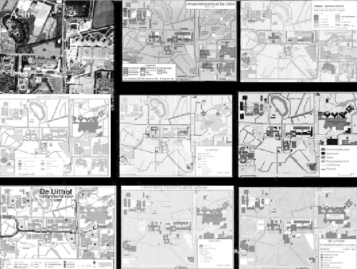
Fig. 2.8 Student maps of Utrecht University campus, based on aerial photograph (top left)
For the map reproduction classes we had in Utrecht University in the 1980s,
prior to the advent of digital techniques, we did a simple exercise to produce a map
of the university campus. Students could select their own target audience for this
campus map, and customize the spatial information to convey accordingly. Here
again the results are most instructive when compared. That is because they show
how—even with very simple data, as on the function of buildings, their number of
floors or the transport facilities—a host of different images will emerge, based on
different decisions regarding information hierarchy, preferential colour schemes or
student outlook—even differences between car-owning students and public trans-
port advocating students would stand out on the maps (Fig.
2.8
).
Part of the Utrecht cartography programme consisted of fieldwork, in France,
where one of the assignments was to update an existing topomap, and another to do
a land use survey of a small area. Apart from the generalization aspect, the results
here provided another example of the impact of individual land use classification
decisions, and of the generalization rules followed, even if the assignment—to
produce a land-use based map 1:15.000 for the area for cyclists and hikers—would
let us to expect rather homogeneous results. The realization that the same reality, to
be mapped to the same specifications, could be reflected in so many different, but
valid views of the same reality certainly was an eye-opener for the students.
Search WWH ::

Custom Search