Geoscience Reference
In-Depth Information
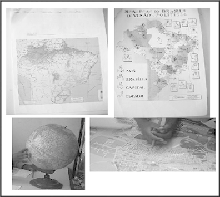
22.3.3.2 From the World to My School
The second stage of the project came up with the proposal of giving the pupils an
idea of Geographic Space before talking about environmental issues. We used a
globe and different maps, including one of our cities, Rio Claro, as our idea was to
give the pupils a global and a local idea of space (Fig.
22.6
). Having found where
Brazil is located in the globe, they were given a colorful map of Brazil printed in A4
size in order to check if they were able to identify which country it was. This
activity aimed to encourage them to acquire Portuguese vocabulary in the written
form, and present them important elements of maps and charts (the separation of
title, content and caption). The map of the political division of Brazil was given
after that, and they were supposed to paint only the province in which they lived.
The map was printed without color, leaving all the states represented with white
background, so that pupils could paint our state. First we provided them with the
globe and the physical map, and then gave them the political map that aimed to
show them that space is not “born” with boundaries. The idea was first to introduce
Fig. 22.6 Materials used in this activity
Search WWH ::

Custom Search