Geoscience Reference
In-Depth Information
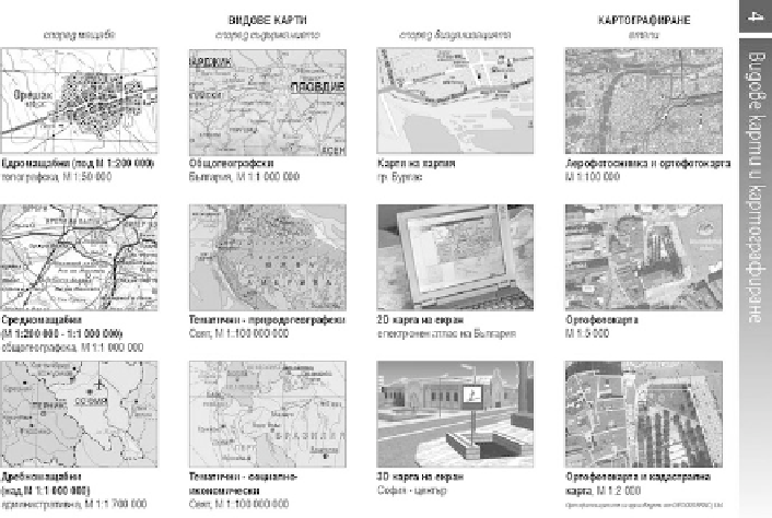
Fig. 17.6
Visualization of different kinds of maps and mapping
Use of examples in topic explanations. This method was used to explain
different types of mapping and maps (Fig.
17.6
).
Use of colours on the borders of the pages or under the title to indicate the
chapters of atlases.
All these improvements accompanied by the high quality printing and publish-
ing make the atlases popular and attractive for the pupils, parents and teachers.
17.3.5 New Topics
The adoption of the new topics in the atlases and wall maps is related to the new
curriculums in geography and history. Cartographers must adjust their products to
the new curriculums because their cartographic assets should be approved by the
Ministry of Education. Thereby, these products could be used in Bulgarian schools.
17.3.5.1 New Ideas and Maps in the Geographical Atlases
Some the new topics are included in order to facilitate the teaching of other topics
that the pupils find difficult to understand, such as different kinds of mapping and
maps (Fig.
17.6
) or map projections (Fig.
17.7
).
Another reason is to help teachers and pupils to understand themes that are more
complicated in their lessons. Map projections represent such a challenge. We try to
Search WWH ::

Custom Search