Geoscience Reference
In-Depth Information
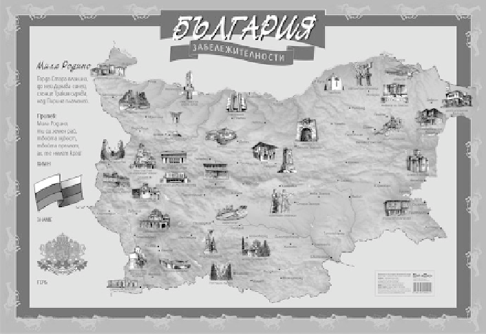
Fig. 17.2
Major sights in Bulgaria
Give them additional knowledge in a distracting way, namely, by playing games
and drawing pictures;
Show them the artistic aspect of the maps and train them in the aesthetical view
of maps.
All participants in this initiative believe that these kids will learn how to use
maps in an appropriate way. Facing the maps prepared of high quality, teachers and
kids will be able to distinguish the good and useful products from the low quality
ones, which are sold on the free market.
17.3.2 Electronic Versions of Cartographic Products
Pupils and kids share the values of a new generation, which is using computers
every day for every need. This is why the most appropriate solution is to propose
geographical and historical mapping visualization through the medium of elec-
tronic cartographic products. Several ideas have been realized worldwide. An
electronic school atlas of Quebec is a good example as a product: its structure
and content is related to the child (Anderson et al.
2003
). Other research (Pfander
et al.
2004
) represents the Arizona Electronic Atlas (
http://atlas.library.arizona.edu
)
as an interactive Web based state atlas, which allows the users to create, print or
Search WWH ::

Custom Search