Geoscience Reference
In-Depth Information
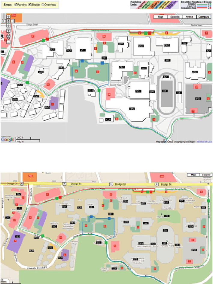
Fig. 13.8 Campus map overlay for the University of Nebraska at Omaha. The tiled representation
is supplied at three levels of detail and overlays over a standard Google Map
Fig. 13.9 Parking and shuttle layers superimposed on a Google Map of the University of
Nebraska at Omaha campus
entity would have difficulty justifying this expenditure. Application Programmer
Interfaces represent a way to integrate information with the online map. For a
variety of reasons, this form of map delivery is the most cost-effective way of
making maps available to the online map user.
Search WWH ::

Custom Search