Geoscience Reference
In-Depth Information
delivery. Map users did not want to wait for the map and a method was devised to
appease the impatient online map user. This method involved dividing the map into
pieces, or tiles. It is important to understand the tile-based mapping transition and
what it means to cartography. We begin by examining server-based mapping.
13.2 Server-Based Mapping
Interactive server-based mapping began in 1993 within months after the introduc-
tion of the Mosaic browser in March of that year. The first interactive online
mapping application was developed by Steve Putz (
1994
) at the Xerox Palo Alto
Research Center (PARC). His Map Viewer program allowed the user's client
computer to create on-demand maps from a geographic database. Each interaction
with Map Viewer would request a new map from the server that was zoomed in on a
specific point (see Fig.
13.1
). Individual maps were generated in a graphic file and
embedded into a web page.
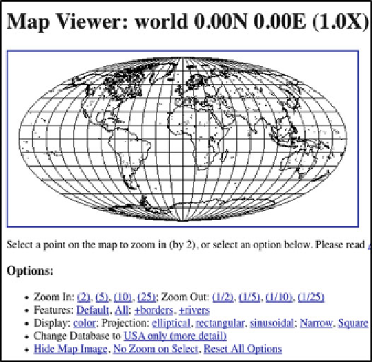
Fig. 13.1 Xerox Parc Map Viewer was an early example of an interactive web map. By
interacting with a mapping program on the server, the site made it possible to generate a map of
the world at different zoom levels. The resultant map was converted into a graphic file and inserted
into a web page
Search WWH ::

Custom Search