Travel Reference
In-Depth Information
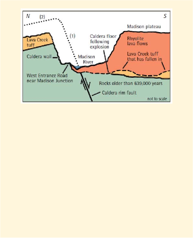
Figure 1. Cross section of the Yellowstone Caldera rim.
The cliffs you can see across the river from the entrance road west of Madison Junction
are a good example of these lava flows. Here they form the northern edge of the Madison
Plateau, which reaches southwest approximately to the Idaho line, occupying 250 square
miles (650 sq km). You can see good examples of its lava close up along the drive through
Firehole River Canyon just south of Madison Junction. The caldera is roughly oval, about
30 by 45 miles (48 by 72 km), and partly surrounded by cliffs, like a volcano's crater but far
larger. Cliffs extend along the road for about 8 miles (13 km) eastward past Madison Junc-
tion to Gibbon Falls, forming the northern wall of the caldera. This north-to-south cross
section shows the northern rim of the Yellowstone Caldera just west of Madison Junc-
tion. When the Lava Creek tuff erupted and covered the older rocks 639,000 years ago, the
ground surface then collapsed into the space left by the erupted tuff and so created the cal-
dera. Most of the tuff landed outside the caldera, forming thick layers of tephra; some fell
back into the caldera and formed uneven and irregular mounds and blocks. The arrows
show the relative motion of the
fault
at the edge of the collapsed part.
Rhyolite
lavas later
flowed out and covered the caldera floor and sometimes also covered the caldera edge.
The dotted lines show approximately: (1) where the original caldera edge at the fault sur-
face was before erosion and (2) where the surface of the tuff was outside the caldera be-
fore erosion. The dashed line shows the caldera floor after the eruption with discontinuous
blocks of Lava Creek tuff lying on top of older rocks.