Travel Reference
In-Depth Information
Little Bear Creek runs through a field of flowers below Beartooth Butte.
An alternative if you're coming from east of the park is the Chief Joseph Scenic Byway
(Wyoming 296), which crosses the Absaroka Range. It affords breathtaking views of the sur-
rounding countryside and access to Sunlight Basin, with its ranches and summer homes. The
Chief Joseph Highway joins U.S. 212 a few miles east of Cooke City. The distance from Billings
to the Northeast Entrance this way is about 150 miles (240 km); from Cody, about 80 miles
(130 km). Because its summit is lower than that of the Beartooth Highway, this road is open
earlier in spring and later in fall.
Visitors suffering from a fear of heights should be forewarned that there are several switch-
backs on these roads with long views to the valleys far below.
The Northeast Entrance was the last to be opened, in 1936, and still has the fewest cars
passing through it. Cooke City and Silver Gate just outside the park have tourist accommod-
ations, as does Red Lodge.
NORTH ENTRANCE
The North Entrance was the first, and for years the most popular, way to enter Yellowstone.
Lower in elevation than any of the others, this entrance has always been the most accessible
by road (and formerly by rail) from Montana towns such as Helena, Butte, Billings, or Boze-
man.
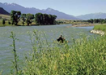
You reach the North Entrance via Interstate 90 to Livingston, turning south on U.S. 89.
Following the north-flowing Yellowstone River, you pass through serene Paradise Valley, now
famous as a resort area for movie stars and other high-profile Americans.
The Yellowstone River is popular for rafting, kayaking, and fishing.