Travel Reference
In-Depth Information
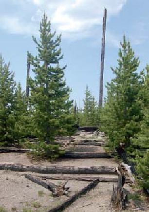
Twenty years after the fire, lodgepoles were thriving. Both pictures were taken at the Fire and Blow-
down exhibit.
9.9/1.7 Virginia Cascade Road
affords several good views of the Gibbon River's
60-foot (18 m) plunge over volcanic rock. The 2-mile (3.2 km) side road is narrow, steep, and
curving— and difficult for the park to maintain. Engineer Hiram Chittenden called it “a pos-
itive menace to the lives of travelers.”
Virginia Cascade and the nearby Virginia Meadows, through which the Gibbon River
flows, were named for the wife of Charles Gibson, head of the Yellowstone Park Association,
a late-nineteenth-century hotel concessionaire.
A picnic area is at the far east end of the one-way loop road.
11.0/0.6
Norris Meadows picnic area. The Gibbon River meanders past on its
way to drain Norris Geyser Basin to the west.
11.6/0.0
Norris Junction. The lodgepole snags standing to the southwest of the junction are
left from a prescribed burn in 2007.
Norris Geyser Basin is straight ahead (west), Obsidian Cliff and Mammoth Hot Springs
are to the north, Madison Junction to the south (then southwest), and Canyon Junction to the
east.