Travel Reference
In-Depth Information
Snow avalanches are common in this area of steep mountainsides. In the spring, park
rangers fire a cannon to try to create small snowslides and prevent the snow buildup that
causes greater avalanches.
An unmaintained fisherman's trail, not shown on current maps, starts south of Eleanor
Lake and follows Clear Creek down to the Thorofare Trail.
From Eleanor Lake to the edge of Mary Bay, evidence remains of the Grizzly East complex
of fires, which burned more than 25,000 acres of forest in late summer of 2003.
8.7/17.3
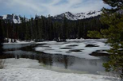
Sylvan Lake picnic area, with tables near the lake and across the
road. Fishing in Sylvan Lake is catch and release only.
The mountain visible beyond the southeast end of Sylvan Lake is the aptly named
Top
Notch Peak.
Above the trees to the south and closer to the lake is
Grizzly Peak.
Look on
Grizzly Peak's northwest side for an obvious
cirque,
a natural amphitheater carved by a glacier.
9.1/16.9
Northwest end of Sylvan Lake.
11.0/15.0
Teton Point turnout for the first good view of part of Yellowstone Lake, Mount
Sheridan across the lake, and (on clear days) the Tetons.
12.3/13.7
he road makes a horseshoe curve to cross Cub Creek.
14.2/11.8
Unnamed ponds can be seen briefly along the road. The gas bubbles and turbid wa-
ter in the ponds and colorful hillsides beyond them indicate a hydrothermally active area.
14.8/11.2
The excellent panorama here, historically called the Teton Overlook, is described
on
page 166
.