Travel Reference
In-Depth Information
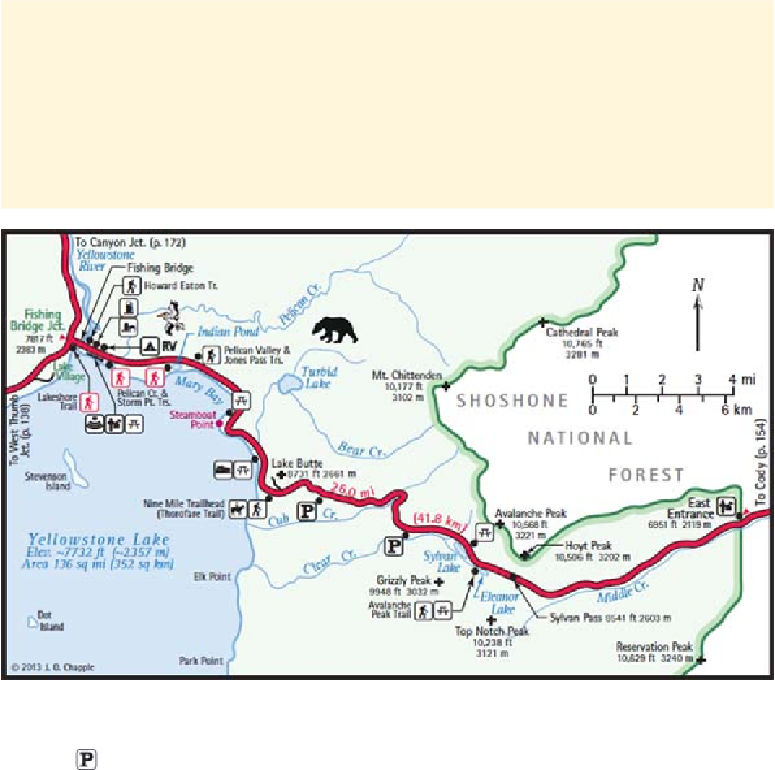
In 1929, the original eastern border was revised, turning over to the Forest Service any
land east of the Absaroka summits and, at the same time, annexing some of the headwa-
ters of streams already in the park. Thus, Crow and Jones Creeks, which flow east out of
the mountains north of Sylvan Pass to the North Fork of the Shoshone River, are entirely
outside the park. Almost all the tributaries of the Lamar River (farther north) are within
the park. Most of the eastern border now follows drainage divides, meandering along ridge
crests and over mountain peaks.
East Entrance to Fishing Bridge Junction
3.0/23.0
For the next mile or so, there are several parking areas and a road toward Middle
Creek. Some of the turnouts provide good views of the mountains.
The original East Entrance Road followed Middle Creek more closely than it does now.
Pleasant features of the present road in early to mid summer are the riot of color from road-
side wildflowers and the numerous small waterfalls that rush down from the hillsides above.
But don't drink the water—it may not be safe.