Travel Reference
In-Depth Information
or to visualize where the water is going. Maps show the Continental Divide as a thin line
crossing irregularly from the park's western boundary to leave the park near the southeast
corner. What does this line represent?
A drainage divide is a geographer's term for the topographic boundary between adja-
cent drainage basins or watersheds. Runoff from precipitation that falls on one side of the
divide will find its way into one stream system; on the other side, surface runoff discharges
into another stream system.
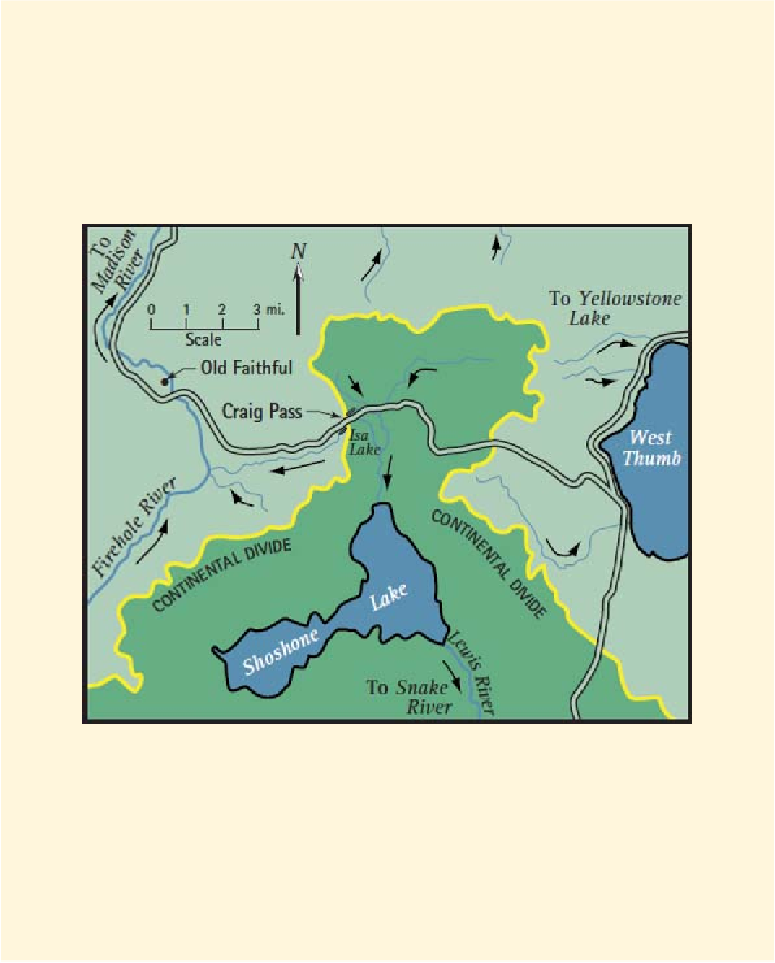
Figure 3. Map showing stream flow directions
(black arrows)
and the Continental Divide.
The Continental Divide, (also known as the Great Divide) is the main watershed
boundary of the North American continent. As shown in Figure 3, the divide separates
areas that drain to the Pacific Ocean (green) and the Atlantic Ocean (lighter green). The
area around Old Faithful Village drains to the Atlantic Ocean via the Firehole River, a
tributary of the Madison River. About 9 miles east of Old Faithful, the Grand Loop Road
crosses the Continental Divide at Craig Pass, entering the watershed of the Lewis River,
which flows to the Pacific Ocean via the Snake River and eventually the Columbia River.