Travel Reference
In-Depth Information
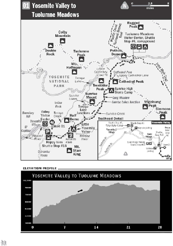
From the Happy Isles Shuttle Stop #16 (4,035 feet), walk along the road
crossing the bridge over the Merced River and then turn right to follow the river
south along the dusty, well-defined path. Within a quarter mile, pass a sign for the
High Sierra Loop that charts a journey that includes the mileage of the entire John
Muir Trail to Mount Whitney (211 miles!). Follow the path as it ascends rather
steeply along the river canyon and around Sierra Point, a rocky ledge on the southw-
est ridge of Grizzly Peak that's named after the Sierra Club. This is a fitting begin-