Geology Reference
In-Depth Information
to limited fracture dimensions. However, most carbonate rocks are karstified
during geological time, with the development of poljes, sinkholes, dolines,
caves etc. thereby forming highly productive aquifers. Generally less than 50
ky are required for development of an integrated karst network (Atkinson et
al., 1978; Dreybrodt, 1998).
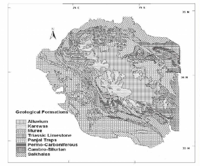
Figure 1.
Geological map of Kashmir (modified after GSI, 1977)
Kashmir Valley (Jhelum basin), one of the many NW-SE oriented
depressions of regional dimensions of Himalayan mountain system is an
intermontane valley bounded by four major ranges; Pir Panjal Range towards
SW, Saribal Range SE, Great Himalayan Range towards NE and Qazinag
Range towards NW. The valley is about 135 km long and 40 km wide with
a floor which in the Jhelum floodplain is only 1585 m above sea level,
covering an area of about 12,757 km
2
. It lies between the longitudes 33°25 N
and 34°32
E. The Valley has been described
as a great synclinal (de Terra and Paterson, 1939; Wadia, 1975), seated on
the back of a vast nappe, Kashmir nappe (Wadia 1931). Spate and Learmonth
(1976) described the complexity of physiographic features of Kashmir Valley
as “predominance of majestic mountain ranges with snow clad peaks, large
longitudinal valleys of subsequent streams occupying deep gorges, transverse
gorges cut across the ranges by antecedent streams, strategic mountain passes
N and latitudes 74°0
E and 75°30